
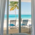


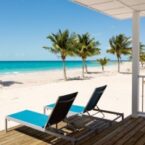
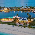

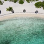


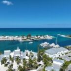


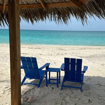
Cape Eleuthera Resort and Marina, an intimate Bahamas Out Island or as the locals say, “Family Island” escape like no other. Our Oceanside resort and marina is a perfect setting for families and couples looking to get away. We have nearly 4,500 acres for you to explore, three private beaches to relax on, and world class fishing and diving for vacation adventures.


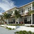
Welcome To Your Home At Cape Eleuthera
Our Specials

Booking window
March 16, 2026 – June 30, 2026
Stay Window
August 1, 2026 – October 31, 2026

Booking window
March 16, 2026 – June 30, 2026
Stay Window
August 1, 2026 – October 31, 2026

Booking window
December 11, 2025 – December 31, 2026
Stay Window
January 1, 2026 – December 31, 2026

Booking window
July 1st, 2025 – June 30th, 2026
Travel Period
July 8th, 2025 – October 31st, 2026
Blackout Dates
7/4th – 7th, 2025; 11/28th – 11/30th, 2025;
4/17th – 20th, 2026; and 7/3rd – 6th, 2026
4/17th – 20th, 2026; and 7/3rd – 6th, 2026

Booking window
July 1st, 2025 – June 30th, 2026
Travel Period
July 8th, 2025 – October 31st, 2026
Blackout Dates
7/4th – 7th, 2025; 11/28th – 11/30th, 2025;
12/19th, 2025 – 1/1st, 2026; 4/17th – 20th, 2026;
and 7/3rd – 6th, 2026
12/19th, 2025 – 1/1st, 2026; 4/17th – 20th, 2026;
and 7/3rd – 6th, 2026

Booking window
July 1st, 2025 – June 30th, 2026
Travel Period
July 2nd, 2025 – October 31st, 2026
Blackout Dates
NONE

Booking window
July 1st, 2025 – June 30th, 2026
Travel Period
July 8th, 2025 – October 31st, 2026
Blackout Dates
7/4th – 7th, 2025; 11/28th – 11/30th, 2025;
12/19th, 2025 – 1/1st, 2026; 4/17th – 20th, 2026;
and 7/3rd – 6th, 2026
12/19th, 2025 – 1/1st, 2026; 4/17th – 20th, 2026;
and 7/3rd – 6th, 2026

Booking window
July 1st, 2025 – June 30th, 2026
Travel Period
July 8th, 2025 – October 31st, 2026
Blackout Dates
7/4th – 7th, 2025; 11/28th – 11/30th, 2025;
12/19th, 2025 – 1/1st, 2026; 4/17th – 20th, 2026;
and 7/3rd – 6th, 2026
12/19th, 2025 – 1/1st, 2026; 4/17th – 20th, 2026;
and 7/3rd – 6th, 2026
Accommodations


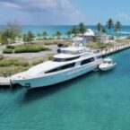
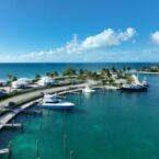
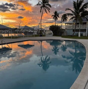
Marina
DROP ANCHOR INTO THE DEEP BLUE
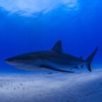
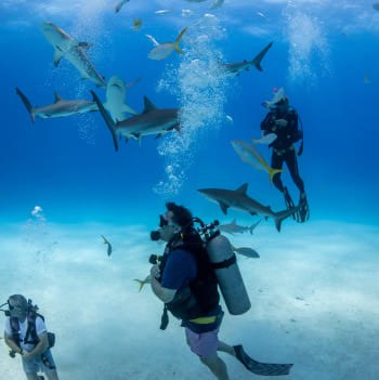
Make memories that last a lifetime! Cape Eleuthera has some of the best game fishing and deep-water scuba diving in the Bahamas. Our marina is a longtime favorite for Bahamas Out Island adventurers. The marina accommodates vessels up to 200’ LOA with a controlling depth of 12’ and offers 47 slips for daily or long-term rental.
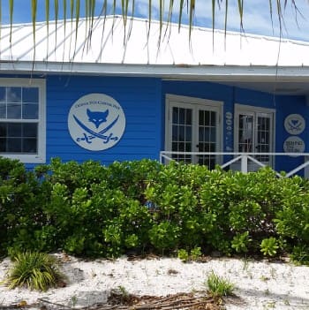
Oceanside Dining
Discover local Caribbean cuisine in a casual-cool ambiance, where your favorite food and drinks are served with a special Bahamian twist.
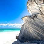
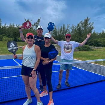
Things to do
Your adventure awaits… Here are some insider tips to assist with charting your escape to our paradise, Cape Eleuthera!

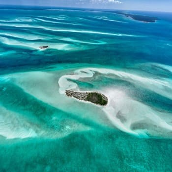
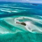
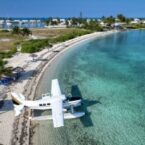
Change Your Latitude
Part of the Family Islands (also known as the Out Islands in the Bahamas), we are located 60 nautical miles east of Nassau. Here are some insider tips to assist with charting your escape to our paradise, Cape Eleuthera!
Captured Moments
Escape to Cape Eleuthera – Explore our family island, be inspired by the island, and create memories that last a life time.”